top of page

Elk River and Landslide Lake (Approach to Mt Colonel Foster) Trip Review

  • Writer: Sophia
    Sophia
  • Sep 21
  • 12 min read

Updated: Nov 15


Beautiful mirror-like reflection in an alpine lake

(August 2025)


Elk River and Landslide Lake is an excellent backpacking trip that takes you into the very heart of Vancouver Island's Strathcona Provincial Park, following the icy Elk River all the way up to Landslide Lake, Berg Lake; and finally, Mt Colonel Foster, the island's 4th-highest peak. The hike is typically done in 3 nights as an out-and-back trip, being mostly level-ground walking with very minor scrambling involved on the 2nd half.


Here I'm going to talk about:


For this trip review, I've decided to provide as many photos as I could to give you the best opportunity to see the hike for yourself and decide what fits best. Enjoy!


Trip Rating: 5/5 STARS


Ranked first out of the Top 10 most-Instagrammed hikes on the island, this incredible trail is 100% worth the adventure. Plus, it's quite relaxed and family-friendly for most of the way. Be aware that young children might struggle with the length of the trail and certain scrambling parts near the end. As you move into the second section, you'll be awarded with breathtaking views and stunning photo ops, though the path does become slightly more challenging with route-finding and bushwhacking being involved. This trail is also often used by climbers and mountaineers to gain access to Colonel Foster, Rambler Peak, Elk Pass, Elkhorn Mountain, and other peaks in the area.


NOTE: THIS TRAIL CAN BE DONE AS A DAY HIKE! However, keep in mind that it will be just under 30 km total of relentless hiking and potentially scrambling in some areas. It will be around 3-6 hours of hiking, depending on your speed and efficiency. Groups attempting to complete the hike in this style should be prepared to start early and head back before dusk, to make it to the parking lot before complete sundown. If you want to take your time (swim, take photos, etc.) at both lakes, I'd personally recommed giving yourself a more relaxed itinerary to enjoy this hike.


Getting There:


From Victoria, follow Trans - Canada Hwy/BC-1 N and BC-19 N to Campbell River, then turn West to Hwy 28 (Gold River Hwy) for ~1 hr until you reach a sign for the trailhead turnoff. It's anywhere from 4 to 5 hours of non-stop driving depending on traffic and conditions, so plan your trip beforehand to avoid any surprises on the road.


Campbell River: A moderate-sized town which offers many great Airbnb's, hotels, motels, and more for those looking for accommodation. Also, check out the absolutely delicious Freyja Croissants (https://www.freyjacroissant.ca) downtown for a sweet treat at this amazing Scandinavian-style bakery before (or after) your hike.


Gold River: Farther west on Hwy 28, this minor 'village' is just 20 minutes of driving from the trailhead. The population is just over 1,000 and mostly comprised of miners, so it's small compared to the other cities in the area. This could be a good accommodation option, but don't expect luxury here - the town seems to have everything but a grocery store!


Climbing in the Area: For adventurers looking to add a day of sport/trad climbing into their itinerary, the Crest Creek Crags is an excellent granite sport climbing destination with climbing ranging between YDS 5.4 and 5.13. The crags are located just 15 mins west on Hwy 28 after the Elk River trailhead turnoff.


Map of driving directions, southern Vancouver Island
Driving directions as of mid-day traffic (11:48 am) from the Swartz Bay ferry terminal to the official trailhead. Note that narrow highway locations such as Malahat and frequent traffic lights in city centres of Langford, Duncan, Ladysmith, and others may add extra minutes to your drive.

Nearby Accommodation Options:


Hiking with a heavy pack on your sholders after driving the whole day can be rough for most people, so this list of nearby accommodations is worth checking out. Plus, the upside is that you get to pack the night before and make sure all your gear is sorted out well.


Comox Valley: While slightly farther away, the Comox Valley hosts three cities (Courtenay, Comox, and Cumberland) all which offer many Airbnb's, hotels, motels, and more. The Comox Valley is about 1.5 hours away from the trailhead.


Also, check out the WIP Climbing Centre in Courtenay for excellent indoor comp-style boulders and a great facility. https://wipclimbing.com


Campbell River: As explained above, Campbell River is probably the best option for hikers looking for less expensive overnight stays in town. There's even a climbing gym - surprising for the sizes of this town!


Strathcona Park Lodge and Outdoor Centre: A nature-oriented centre located right on Upper Campbell Lake (just off Hwy 28), about 20 mins away from the trailhead. This lodge offers room rentals for min. 2 nights in the summertime and 3 in the winter months. While this option may be slightly pricier, parties interested in exploring other hikes around the area may find this a great option. See the details at https://strathconaparklodge.com/stay/guest/


Gold River: Finding a hotel may be a struggle here, plus you'd have to pack you own groceries, but it's worth looking into. The Gold River Municipal Campground (first-come, first-serve) does offer both campsites and RV sites for parties interested to explore the area bit more.


Elk River Official Trailhead Parking Lot: The majority of hikers leave their cars here while on the trail, so staying the night in your van and resting up here can be a good idea (there are plenty of spaces down left at the turnaround area). Just be prepared that this parking lot can get absolutely packed when in season and on weekends. AN ADDITIONAL PARKING FEE MAY BE REQUIRED TO LEAVE YOUR VEHICLE HERE.


Trail Description:


The official Elk River Trailhead Parking Lot can get very busy during peak summer months and on weekends, so plan your timing correctly. I'd recommend starting early (6 - 8 am) on Monday or Sunday as most people on the trail will be hiking OUT on those days. This way you'll get optimum car spots on the parking lot - plus first pick for campsites on the trail!


Start out at the Elk River trailhead, and after a few tight switchbacks through a short clearcut, descend back to the river and follow a rooty, shaded path for the majority of the day. I recommend you don't pack over 2 litres of water per person as the trail often dips down to the river, offering great refill and cool-down spots. During the winter months, many parts of the trail will be muddy and even washed out, so wear waterproof footwear. At about 5.5 km you will reach the Butterwort Creek campground. Here, several gravel clearings make great camping options for latecomers, families with young children, and anyone splitting the hike into 2. (Note: this will add an extra 1-2 nights to your trek). This campsite has 2 food caches, 1 outhouse toilet, and space for approx. 8 tents.


Another 4 km will get you to the Gravel Flats campground: a slightly larger, scenic campsite with an outhouse and 2 food caches as well. From here, the trail kicks up as you follow cairns and flagging tape near Landslide Lake in about 2 km. This picturesque, perfectly circular lake is an amazing swimming spot for hot days, and the main landmark of the trail. Plus, you'll get amazing views of Colonel Foster's East Face to the northwest, and of Elkhorn Mountain behind you.


For the trek to Berg Lake (aka Foster Lake), it's another 3km one way as you navigate tricky bushwhacking sections around Landslide Lake. A very low-grade scree slope is your final challenge until gaining full view of impressive Colonel Foster over turquoise Berg Lake. An extra hour around the tarn takes you to the famous ice caves, and don't forget to take a dip in the icy waters!


  1. Elk River Official Trailhead (turnoff on Hwy 28 (Gold River Hwy)

  2. 0 - 0.7 km: Switchbacks and a short clear-cut

  3. 5.5 km: Butterwort Creek Campground (first-come, first-serve)

  4. ~9 km: Gravel Flats Campground (first-come, first-serve)

  5. ~11 km: Landslide Lake

  6. ~14km: Berg Lake (aka Foster Lake)


  7. Colonel Foster Base: Two main approaches lead from Landslide Lake.

    #1: Trek directly right over the log outflow area (instead of left once at the fork) to gain access to the North Tower. This is considered the 'truest' way to complete the Summit Traverse.

    #2: For the South Col, low 5th class slabs lead from the left of Berg Lake, depending on snow cover. Note that most routes require rappelling for descent or backtracking along the summit to either end. Other routes may have alternate approaches.

    #3: This PDF can provide other important details: https://www.wildisle.ca/downloads/route_cards/mt_colonel_foster.pdf


NOTICE FOR ALL CLIMBERS: The trail marker at the Gravel Flats campsite specifically mentions not to camp at Landslide and/or 'Burg' (Berg) Lakes, but the park rangers don't seem to specify the base of mountain itself. If your route requires you to do so, bivvying at the North Tower is a popular choice. (Most routes do not require hauling and/or bringing a portaledge).


Backcountry Camping Fees:


For this hike, standard Strathcona Provincial Park Backcountry Camping fees apply during the summer months (June 15 - September 30). This information is current as of August 2025:


16+ years old: $10

6-15 years old: $5

Under 6: No fee


While camping, please follow standard Leave No Trace principles and use all available food caches (or suspend food from trees, if needed). On this hike the three outhouses are located at: 100m from the parking lot, at the Butterwort Creek campground, and at the Gravel Flats campground. Should you need to improvise a camping bathroom, please stay away from drinking water sources and head at least 200m upslope.
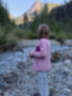
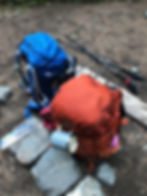


OUR TRIP PHOTOS:


Campbell River airbnb
The Airbnb in Campbell River. Booking a night in lets us rest after the drive and pack well for the next day. Definitely recommend looking into hotels/hostels/motels/airbnbs to optimize your energy level for the hike.
Early sunrise over the horizon
Up early at 5 am: Sunrise over Sunshine Coast the morning of our trip. Sadly, the camera doesn't really capture it.
Mountain lake in early sunrise light
Majestic Upper Campbell Lake during early morning hours from Hwy 28.
A person standing on a log in the forest, perspective shot
The hike greeted us with cool features just 30 min in! There's Mom on a long slippery log - nice to be back on level ground after the beginning switchbacks.
Reflective orange trail marker on a tree in the forest
Reflective orange trail markers designate the trail. You won't get lost here!
A teen girl backpacking in the forest picking berries
Huckleberries are easy to identify and grow with great abundance on the trail.
A rooty hiking trail meandering in the shaded temperate rainforest
This is what the trail looks like for most of the first day (Trailhead - Gravel Flats campground). Shady, rooty, and level. You won't even notice the elevation gain!
Forest clearing looking out onto mountains
First view onto some real mountains in a forest clearing. That's Puzzle Mountain in the very left.
Backpacking hiking campsite lunchtime
Rest stop at Butterwort Creek campground for an early lunch. Having started out at 7:30am, almost 10 now.
A gravel backcountry campsite
Campsites at the Butterwort Creek Campground. Lots of space to choose from, less than a minute walk to the outhouse, and the river within a few steps.
Long bridge over a creek in the forest, perspective shot
The newly-reconstructed bridge over Butterwort Creek.

Cliffs below a forest ridge in the distance
I think this would make a great climbing area... Even though hard to access! ;)

Posing beneath a huge old-growth evergreen tree with a web of roots below
Cool features of the trail! This century-old tree stands promptly over a web of routes. Great photo op!

A backcountry campsite in Strathcona Provincial Park, BC
After about 3.5 hours of hiking, made it to the Gravel Flats campground! This is Elk River that runs all the way down the trail from Berg Lake - your main water source for the entire trail. 0-2 mins of walking from all campsites. (Also exponentially dried-out here in this photo. Wet months will have the river flooding all near areas).
Clear icy water in an alpine river
Incredibly clear (and cold!) water in the river. Still of course remember follow proper backpacking ethics and filter what you drink!
A gravel backcountry campsite in the trees
One of the sites at the Gravel Flats campground. This campground offers sites both by the riverbank (coarse gravel underfoot) and in the forest (packed dirt underfoot). This one's a bit in the middle! :)
A backpacking tent and gear on a campsite.
Our camp. Using the tent fly as a seating pad, lol!
A teen girl posing on a gravel riverbank, swimming
Elk River can be pretty shallow in the summer (about knee-deep), but it's still a good cool-down option after the hike in. Ice-cold, too!
Elkhorn Mountain peering out from behind a forest ridge
The summit of Elkhorn Mountain (2nd-tallest on the island) peeking out from behind a ridge from the Gravel Flats campsite. You'll get full view of the mountain from Landslide Lake the next day, though!
Instant Ramen noodles in a camping bowl
Dinner of Day 1. Instant noodles is the best all-time backpacking meal. Also quick to make, too!
Red huckleberries
If you're there at the right time of year, thimbleberries grow with great abundance around the Gravel Flats campground.
A young girl looking at sunset-lit mountains in the distance, wearing pyjamas and standing in a forest valley
The sun sets fast in the backcountry, so it was dusk by 7. Behind me is the backside of (what we think is) Rambler Peak in sunset light.
Two mugs, dark chocolate, and a deck of UNO playing cards on a rock.
Tea, chocolate, and UNO at camp. I won 3 rounds in a row! ;)
ZOLEO, a backcountry communication device
ZOLEO - our favourite backcountry communication device. Owners of recent iPhone models can boast new satellite connection, but this is a good alternative too. In my family we establish regular check-in times and emergency contact plans - and highly recommend all hikers in the backcountry to do the same.
Alpenglow onto valley peaks in Strathcona Provincial Park, BC
Evening alpenglow onto the Elk Pass and adjacent peaks. The valley's all in the shade now.
Early morning light onto a distant triangular mountain
Day 2. Early morning light onto the nearby peaks. Definitely a lot of my future objectives here, now that I'm inspecting these peaks a bit closer!
Breakfast dishes in the backcountry, a mug of hot chocolate and oatmeal
Breakfast was gone in minutes (chocolate-coconut granola - best all-time backpacking treat!)
Hiking daypack half-packed before a hike
For a day hike to Landslide and Berg Lakes, definitely bring a small daypack to carry your things. We split the load and carried 3 litres of water, plenty of snacks, and of course our swimsuits!
A young girl hiking on a level forest path
5 minutes into the trail. The path here is deceivingly flat.
A young girl pointing at Elkhorn Mountain from a bridge in the forest
First full view of the Elkhorn Mountain from the trail!!! Interestingly, the mountain seems to grow smaller and smaller the farther you go along the trail to Berg Lake.
A hiker tying orange flagging tape onto a bush
Decided to add our contributions to the trail. Route-finding becomes more difficult on this trail if you haven't done it before, so look out for flagging tape, cairns, and other odd markings people leave behind (eg. swimsuit hanging on bush?!).
Waterfall cascading down rock steps
Waterfall! Just 20 mins into the trail
A steep hiking trail leading down a wood staircase
The angle kicks up as soon as we enter the forest with a few switchbacks. But it's still a very manageable hike.
A jagged peak poking out from behind a tree.
First view of Colonel Foster over the treetops! So excited!!!
Mt Colonel Foster, Strathcona Provincial Park
Almost at Landslide Lake now... Colonel Foster slowly growing in height! Honestly, as a height-lover myself I was expecting more of the prominence, but it's definitely one of the most impressive faces you'll find on the island.
A hiker looking out to Mt Colonel Foster over mirror-like Landslide Lake.
Landslide Lake, the main feature of the trail. It's perfectly mirror-like in the morning - just about 9 am now. Interestingly, the 1946 landslide area can be clearly seen to the right of Colonel Foster. A section of the mountain broke off after the earthquake and sheared off a massive slab just next to the lake. The resulting wave flooded most of the forest below.
Path around a lake
Don't be fooled by the seemingly flat trail here around the lake - you've got a long hour of scrambling over roots and trees toward Berg Lake ahead.
Scramby, rooty, bushwhacking path in the forest
The muddiest, most overgrown, and certainly least-pleasant part of the trail around Landslide Lake. Knee-high tree roots make it difficult to move fast, especially for people with shorter legs! ;) At least the shade will keep it cool even during midday heat.
A hiker navigating a step washout drop in a forest trail
Mom navigating a technical drop in the trail. These section swill be completely washed out in the winter months, so keep that in mind.
Pink fireweed blooming in an alpine valley
Fireweed dominates the descent from yet another bump in the trail.
A hiker scrambling up a steep scree slope.
A friendly low-grade scree slope is your final challenge before seeing crystal-clear Berg Lake.
Beautiful circular turquoise lake under a jagged mountain peak, view from above
Landslide Lake is a perfect turquoise circle below the Elkhorn massif.
A young hiker girl posing in the alpine above a turquoise lake and a jagged mountain in the distance
Posing in front of the incredible view. The only downside: really hot air!
Sun rays over a beautiful mountain lake
10 am now and we're finally at Berg Lake! Beautiful turquoise waters nestled under steep rocky faces. The closest you'll get to Colonel Foster without actually climbing!
Panorama of a mountain over a turquoise lake
Panorama of Berg Lake and the mountain's base. Sadly, the phone camera doesn't really capture its true sizes. Right-most you can see where the section of the North Tower sheared off after the earthquake, and the South Col is just above the left glacier. Left of the frame is a cut-off section of the Elk Pass that can be connected to Rambler Peak as well.
A young girl swimming in an alpine glacier lake
Berg Lake's unique pale blue tint is given by melting glaciers and debris from the scree slopes. Cleanest (and coldest!) you'll ever see for swimming spots!
A sunlit shoreline of a subalpine lake in the mountains.
The shoreline of Berg Lake is baked by sun from early morning - finding shade can be a challenge under the low shrubs.
Rocky cairn looking over a turquoise lake and a jagged mountain peak
Cairns mark the trail around Berg Lake. This one has an especially panoramic setting.
A hiker navigating a wet rocky slab on the way down
Navigating steep wet slabs on the descent. Winter months will make this part of the trail almost impossible.
Hiking boots, backpacks, and other gear laid out on the grass
Found some shade by Landslide Lake. About noon by now. Swim time!
The jagged silhouette skyline of a mountain peak in late afternoon
Note the difference of how Colonel Foster looks at noon versus in the morning. The angle of the sun really changes your visibility of the mountain - it's more of a skyline silhouette in the afternoon. If you want a good view of the mountain and its features, get an early start to maximize the timing.
Close-up of wild blueberries on a palm
Wild blueberries and black huckleberries dominate the shrubs near Landslide Lake. Know not to confuse them with other berries, but they do make a refreshing snack.
Hiking daypack laid on a rock below a waterfall
Shade break by the waterfall on the way down. In total, it took us just over 4 hours to complete the hike there and back, plus we spent at least an hour swimming at both lakes.
Bathing suits and towel strung on an improvised clothesline while camping between two trees
Thin cordelette makes drying swim suits easier. Clove hitches and figure 8s will make a secure clothesline, just make sure you can untie it the next morning (my mistake only too often!).
Rehydrated backpacking dinner on a girl's lap
Dinner of Day 2. Rehydrated tomato pasta. Not my favourite but will do after a long day.
Two backpacking packs packed up and ready to go
Day 3, 8 am. All packed up and ready to head back.
Droplets of sap hanging on the underside of a tree mushroom, macro photography
Cool droplets of sap on a tree mushroom! I LOVE macro photography. Just about noon now - it took us longer on the way back because we started out later and the heat really made a difference.
A box of delicious artisan French pastries on a beach in sunlight
Back in Campbell River, and a delicious stop at the Freyja Croissants bakery! Definitely recommend giving yourself a treat on the drive back.

Enjoy your hike!


-- Sophia

1 Comment

Rated 0 out of 5 stars.
No ratings yet

Add a rating
Guest
4 days ago
Rated 5 out of 5 stars.

Great job!

Like

© 2026 Crux Pitch (Sophia Roukhlova).

All images and text are copyrighted. No part of this site may be reproduced in any form except with the permission of Sophia Roukhlova.

Disclaimer: This blog is for informational purposes only. I am not responsible for any misinformation, errors, or accidents resulting from the use or misuse of the provided blog posts. By using this information, you acknowledge and agree that you do so at your own risk.

Note: Some images on this site may have facial identity protection applied. This is for safety purposes only, and please respect the author's decision in applying this protection. :)

  • Instagram
  • Facebook
bottom of page