top of page
  • Instagram
7010cf36-124f-4d6e-ac7c-a8a5bb9bf3e0_edi

5040 Peak via Cobalt Lake Trip Review

  • Writer: Sophia
    Sophia
  • Jun 30
  • 11 min read

Snow-dusted jagged mountain above evergreen forest and a blue alpine lake under a clear sky.
Triple Peak and Cobalt Lake seen from the trail to 5040 summit.

(June 2026)


5040 Peak is one of the busiest hikes on the island - and that's for a reason. This 8.4-km trail takes you through a steep, rooty forest, and into the subalpine, where you'll be rewarded with breathtaking views of the central Island's mountain panorama. Read on for this 5040 Peak via Cobalt Lake trip review for the complete guide!


In this post I'll be talking about:


Trip Rating: 5/5 STARS


The 5040 Peak trail is NOT an easy stroll. The trail kicks up to a steep angle right off the trailhead, and you'll be scrambling up roots, rocks, and slabs most of the way up, which may be a challenge for young children. There are three water sources along this trails, a river access point near the waterfall, Cobalt Lake, and seasonal tarns at the ACC hut. I'll be talking more about this HERE. However, despite the uphill grunt, the views are 200% worth it! After passing the second campsite, you'll be hiking into the subalpine with beautiful wildflowers and stunning 360-degree views. Overall, it's an amazing little peak with a big summit feel, great for fit hikers and climbers looking for a rest day option. This is not the trail to access Triple Peak! The Triple Peak access point starts farther down Marion Main near Effingham Creek, and follows a network of marked and/or cairned trails. GPS navigation is highly recommended if you are venturing into the alpine. (To access other sections of the McKenzie Range, take separate trails off Hwy 4).


NOTE: THIS TRAIL CAN BE DONE AS A DAY HIKE! However, staying overnight allows you to enjoy the environment and experience incredible sunset/sunrise views, but you will essentially be lugging up twice the equipment. We bagged the summit the same day as hiking in, including a nearly 4-hour rest at the lake and the Hut, stayed a night at the world's most panoramic campsite, and headed down the following day (1 night, 2 days).


Getting There:


From Victoria, follow Trans - Canada Hwy/BC-1 N for about 115 km past Nanaimo, then merge onto BC-4 W/Parksville/Port Alberni. Follow the Pacific Rim Hwy (heading to Tofino) for 53 km past Port Alberni, then turn left onto Marion Main/Marion Creek FSR. The turnoff for this logging road is easy to miss, so look out for several cars that may be parked next to the road.

From Marion Main, 4WD vehicles are HIGHLY RECOMMENDED, if not required, depending on season/current road conditions. At the time of writing (June 2026), the road was in good condition (gravel) up until the switchback turn, where deep water bars deteriorated the steep section and made it nearly impossible for 2WD vehicles. If needed, you can park your car at the 6km pullout and hike the remaining distance. Drive safe!


Climbing in the Area: Check out Mt Arrowsmith on your way back for an extra day of hiking and alpine multipitch climbing! Mt Arrowsmith is known for equally amazing views and classic sport multipitches such as Time Machine (6P, 5.10b) and The Jowl (4P, 5.10b/c). Be sure to do your research before going as these routes are highly dependent on seasonal conditions, and be aware of any closures/approach notices/gear requirements. Know that this is another 30 - 40 km of driving from Port Alberni, and you will need to turn off Hwy 4 onto one of the FSRs depending on route, such as Summit Main or Loon Lake Main. 4x4 vehicles are also highly recommended.


Map of Vancouver Island showing a blue driving route from Victoria to Ucluelet, with red handwritten notes and labels like Port Alberni and Tofino.
Driving directions as of midday traffic from the Swartz Bay ferry terminal to 5040 Peak trailhead.

Nearby Accommodation Options:


Port Alberni: Port Alberni is a medium-sized fishing town located along Hwy 4. It is the gateway to the Alberni-Clayoquot Region and offers gas stations, restaurants, and hotels/motels. The town seems to be scarce of AirBnBs; we stayed at one by Sproat Lake. It takes about 1 hour to drive from Port Alberni to the trailhead.


Parksville/Coombs: Parksville is a small tourist-oriented village known for Rathtrevor Beach; there are many hotels but this may be a slightly pricier option. 10 km west down Hwy 4, Coombs is a very small rural community with camping options and a few possible hotels. It takes about 1.5 hours to drive from Coombs to the trailhead.


Ucluelet/Tofino: Located at the very west end of the Pacific Rim Hwy, these are two villages about 20 mins from each other, popular for surfing and hiking. Tofino is generally busier and more expensive, so if you must, staying at Ucluelet is a good option (though you are passing Marion Main on the drive there). It is another hour of driving East from Ucluelet to the trailhead.


5040 Peak Trailhead Parking Lot: If needed, vehicle camping is permitted on the trailhead clearing. However, it may be wise to head farther down Marion Main to the 'overflow parking' area.


Hiker with orange backpack stands on rocky overlook, arms outstretched and trekking pole in hand, facing vast blue mountain range.
After one last uphill grunt to the second campsite, you won't believe the views that unfold! Here I wandered onto an adjacent mini 'ridgeline' to take this shot - and it was 100% worth it! (Scroll down to see the full photo progression).

Backcountry Camping Fees/Information:


As of June 2026, there are NO REQUIRED tent camping fees for this trail.


There are two designated camping areas along the 5040 Peak Trail: at Cobalt Lake, and at "the hut" (see below). Both areas have tent clearings, a urine-diversion outhouse, and a bear cache. These are about a steep ~1 km apart.


Hišimy̓awiƛ Hut: At the higher campsite (1,350 m), the Alpine Club of Canada operates the spectacular, reservation-only Hišimy̓awiƛ Hut (pronounced Hi-SHIM-ya-wit) . Sleeping up to 12 guests (2 rooms, 6 bunks), it's a popular choice for winter backcountry skiers and families staying several nights. The hut offers mattress pads, power outlets, and solar-, wood pellet-, and propane-powered utilities, but remains a rustic backcountry accommodation rather than a luxury lodge. You cannot access inside the hut without a door code provided with reservation. Know that it is typicaly fully-booked for the summer months well in advance.


Water sources: Drinking water sources are seasonally-dependent at the higher campsite and collected from snowmelt tarns. That being said, it is extremely important to follow drinking water guidelines around this area because you do not want to pollute the only water source for yourself and others. The trail does a good job at explaining, with several signs, which tarns are 'safe' to drink from: facing the Hut, the right-hand side is 'clean,' and the left-hand is 'dirty,' for washing dishes and etc. However, please always use some sort of water filtration system: 'clean' does not mean potable and safe to drink!


While camping, please follow standard Leave No Trace principles and use all available food caches. There is no outhouse at the trailhead. Should you need to improvise a camping bathroom, please stay away from drinking water sources and head at least 200m upslope.
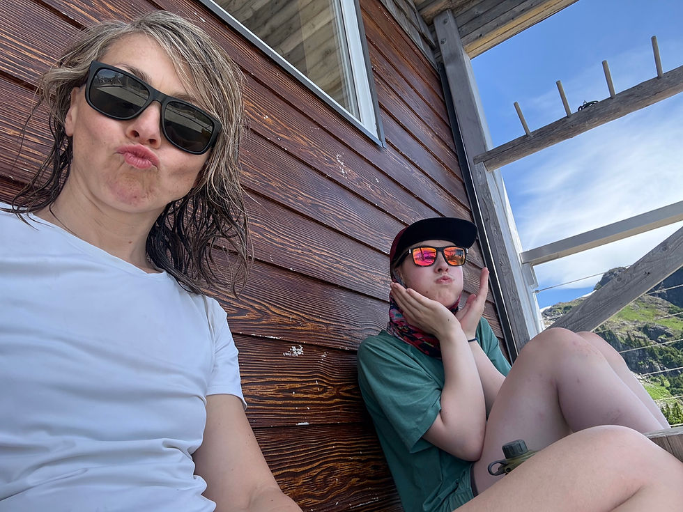

Two women in sunglasses pose on a wooden deck, one puckering lips, with blue sky and mountains behind.
The Hut is a good source of shade during the day: anyone is allowed to sit on the front porch (no reservations for that!). We took a 4 hour rest at the higher campsite to escape the heat and the day-hiker crowds, then summited later in the day.

Trail Description:


This trail is not a very long hike; it took us about 2 hours to reach the lake and 30-40 mins to the next campsite. That being said, it is definitely very doable as a day hike... but if you ask me, nothing beats seeing the entire island light up gold during sunset.


If hiking in the summer, I would highly recommend starting out as early as possible to escape the heat. We began hiking at 6 am and were at the lake by 8. People will find this trail of varying difficulty due to fitness level, a well-conditioned climber used to rugged approaches will have a significantly easier time than a first-time hiker, for example. Cool off by the waterfall and continue scrambling through the forest and up rocky sections towards the lake. It is nearly impossible to get lost due to high traffic for the majority of this trail, but if ever in doubt, always check a GPS instead of eyeing it.


Most people choose to camp at the higher campsite, but going for a swim in cobalt-blue Cobalt Lake (it does earn its name!) is worth a stop. The one downside were the mosquitoes - horrendous amounts of bugs in the early summer months make it nearly impossible to walk around uncovered, in swimsuits especially.


After passing the Hut, continue on as the trail steepens again and takes you along melting moats and scree towards the saddle. Here, the trail branches off, take left for 5040 and right for (unnamed) ridgeline. You should not be at any real exposure on this trail except for one chain-protected corner scramble, as mentioned earlier. Stay on route and avoid taking unpredicted shortcuts. The trail is not well-marked but obvious enough to sight at this point, follow the majority of the crowd if ever unsure. (It took us less than 2 hours to complete the summit hike out and back from the hut.) See below for photos!


  1. 0 km: 5040 Peak Official Trailhead (turnoff on Hwy 4/Pacific Rim Hwy)

  2. 2.5 km: Relentlessly steep, rooty, and heavily wooded. One fixed rope section and several rocky slabs that will be very slippery when wet. 2 river/waterfall access points, 30 mins and 1 hr into the trail.

  3. 3 km: Watch as the forest transitions to subalpine as you near the Hišimy̓awiƛ Hut and second campsite.

  4. 4.5 km: Scramble up moderate scree and rock while navigating your way over 5040's bumpy ridgeline to the summit. The trail is mostly well-protected if you stay on route, except one section where a chain protects an exposed scramble.


OUR TRIP PHOTOS:
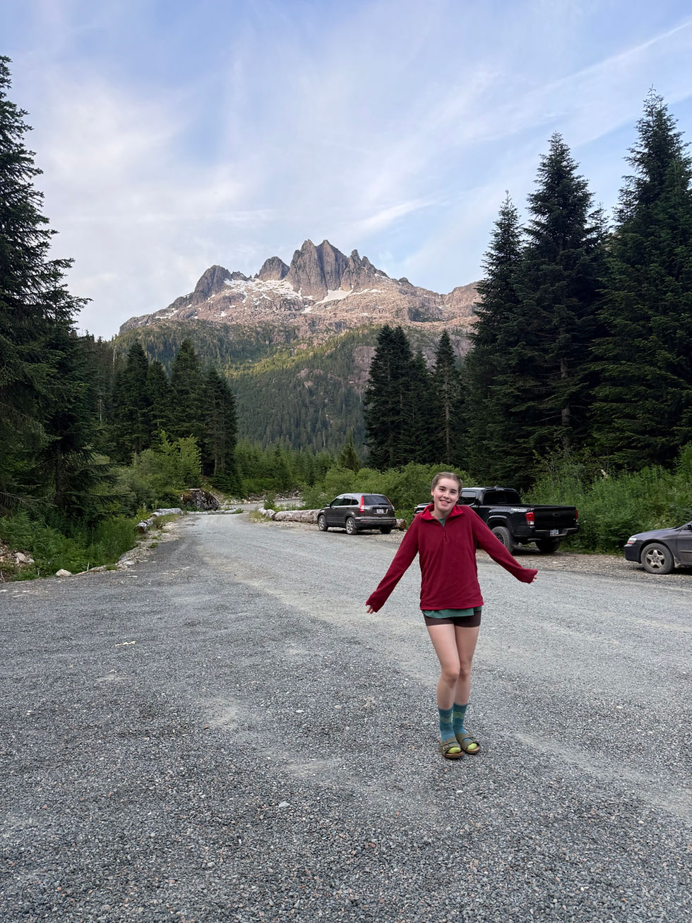

Smiling girl in a red top stands on a gravel road with evergreens, parked cars, and a rugged mountain under a blue sky.
At the parking lot!

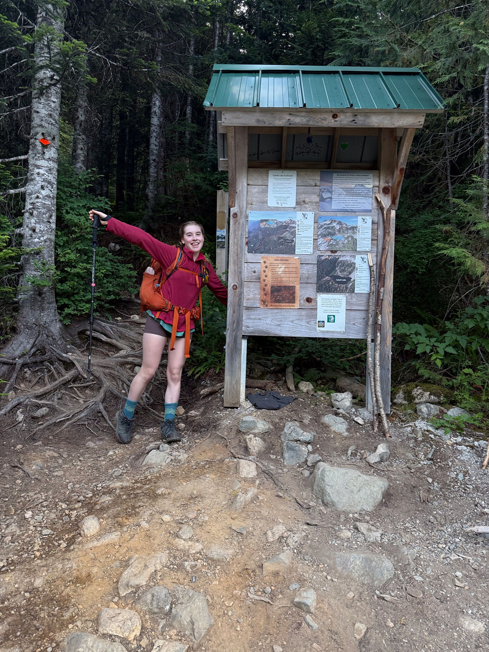
Smiling hiker with trekking pole poses beside a trail information board in a dense forest.
The trailhead is very clear and explains the water system (you will find the same signs when reaching the Hut as well.
Wooden trail sign marked 5040 on a tree in a misty evergreen forest beside a gravel path.
The trailhead sign with Marion Main behind.

Smiling hiker climbs a rocky forest trail with a blue backpack and trekking poles.
Mom navigating the first slab section.

Perspective view onto a rugged and rooty trail from a person in hiking boots standing on a low-hanging log.
Climbing over a low-hanging tree with a steep section behind us (sadly, the phone camera doesn't really capture perspective). Hiking poles do come in handy!
Serene alpine lake reflecting rocky green mountains and wispy clouds, with evergreens and bright sunlit sky.
Cobalt Lake is, well... cobalt!
Smiling girl in sunglasses and black top stands on a rocky coastal meadow with wildflowers and trees under a clear blue sky.
The bugs were genuinely relentless at Cobalt Lake. Look at that halo of mosquitoes around my head! That being said, hiking in late spring/early summer, it may be wise to choose a campsite farther from the lake as mosquitoes do love water sources as much as we do! ;)
Hiker with blue backpack on forest trail, evergreen trees and rugged snow-streaked mountain peaks under a bright sky.
You'll get intermittent views of Triple Peak and McKenzie Range throughout the trail. That's Mom on our way to the Hut.
Hiker with orange backpack stands on a rocky overlook, arms outstretched with trekking pole, facing snowy mountain peaks.
Here it is again: probably my favourite photo of the hike! I'm looking out to interior Strathcona Provincial Park, with the Mt Septimus-Rosseau area visible in front. (Don't quote me for this, island peaks are notorious for looking different from every angle!)
Remote mountain cabin with green roof nestled among evergreens and rocky slopes under a bright blue sky.
Alpine Club of Canada's Hišimy̓awiƛ Hut with 5040 Peak's ridgeline in the background.
The Hut's elaborate driftwood railings leading down to the ground over metal stairs.
The elaborate driftwood railings of the Hut's stairs.
Left view of the Hut's entrance and balcony looking out to interior Strathcona mountains.
While the Hut itself requires reservations, the deck is open to anyone - and a popular lunch spot even for the day hikers!
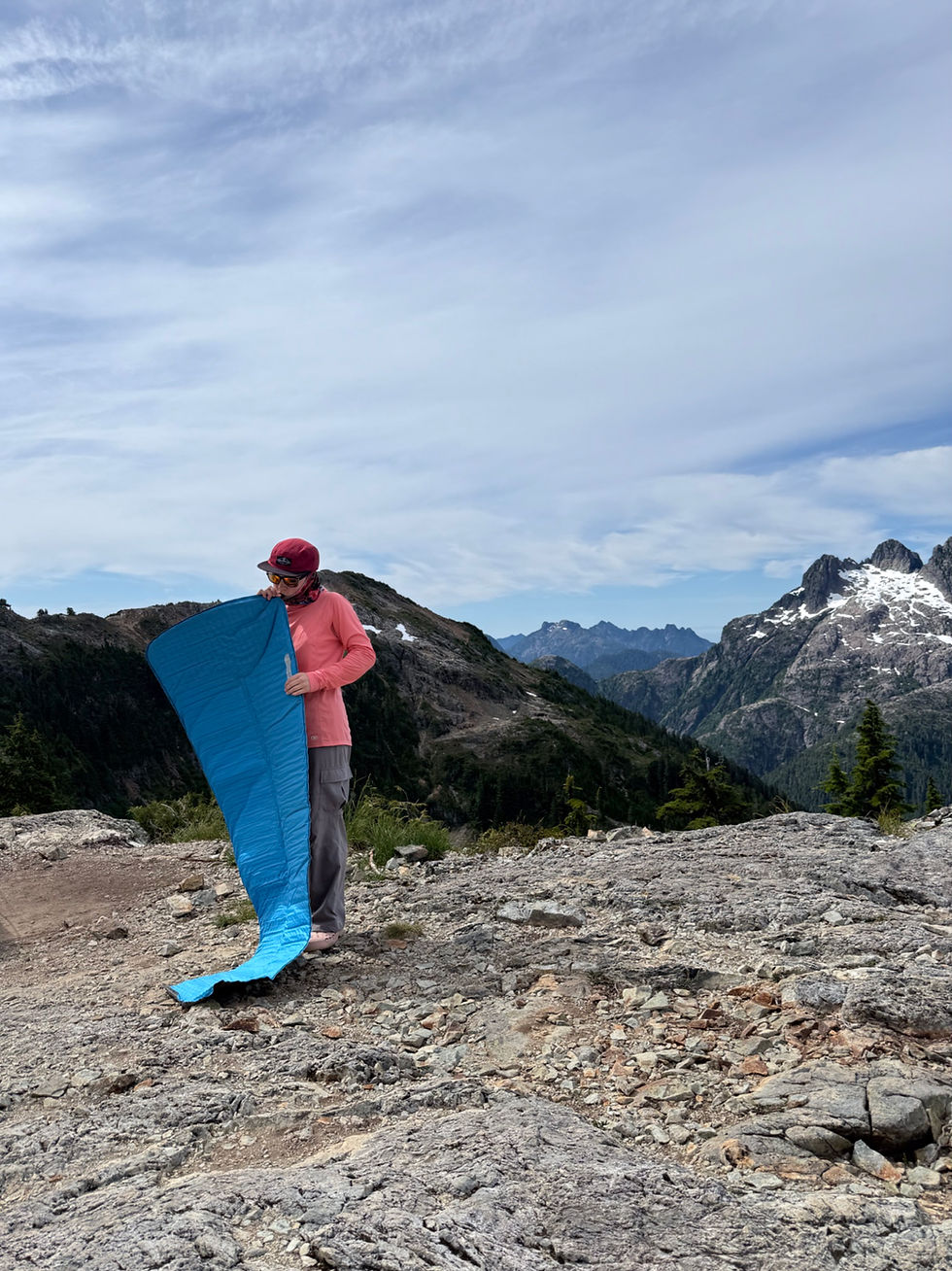
Hiker in pink jacket and red cap holds a blue sleeping pad on a rocky mountain ridge under a cloudy sky.
Setting up camp in (likely) on of the most panoramic campsites on the island. Scroll down to see some sunset shots of this spot as well!
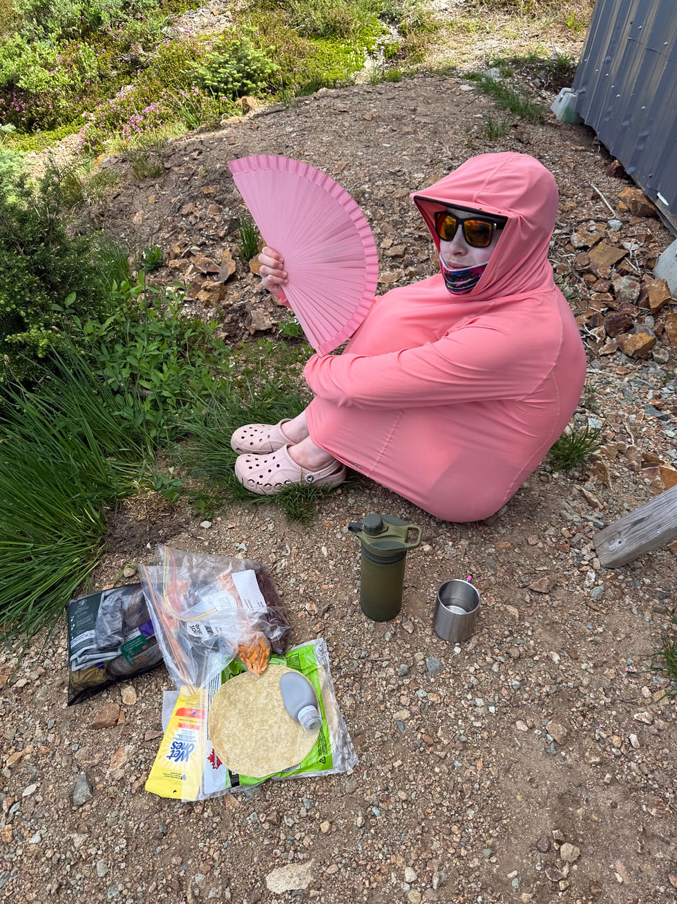
Person in pink hooded bodysuit and sunglasses sits on a rocky trail, holding a pink fan, with camping gear nearby.
Another escaping-the-mosquitoes shot... In the backcountry, it's okay to look like a goof as long as it protects you from both the bugs and the sun! (the ACC Hut provides good shade all day long).
A hiker in a green t-shirt sits in the shade under a rock over a small rocky brook, cooling feet in the water. Alpine scenery in the background.
Finding shade and clean water sources. Steal my keep-cool-on-summit-push hack: take a cotton buff/bandana and soak it in cold water (eg. stream), then wear it on your neck or around your face! SUCH A LIFESAVER (also exactly what I'm doing in this photo).

Hiker in sunglasses and cap poses on rocky trail beside an orange backpack, with sunlit cliff walls and sparse greenery behind.
All packed up and ready for summit push. We were at our campsite at about 10 am (including a 1.5-hour lake swim), then chilled for almost five hours waiting for the crowds to pass and the heat to cool down. The hike is very crowded at around noon because of everybody rushing to bag the summit and head down, so if camping, it's a wise option to wait a few hours.
Hiker in red cap pauses on a rocky alpine trail lined with wildflowers and shrubs on a sunny mountainside.
On the trail towards the ridgeline. Left our big bags at camp and took daypacks - highly recommend all backpackers to do the same.
Alpine scenery with a hiker posing in the distance, on a scree slope dotted with greenery and snowy patches.
Interesting to observe the terrain becoming gradually more 'alpine-y'!
A hiker standing on a steep rocky slope in the alpine, posing for the camera making a heart with their hands and leaning on a trekking pole. Bright blue sky and sharp white granite rock.
The first real 'scrambling' section, Class 3 at most. Felt great to be back on familiar terrain as a climber. I loved this!

Wildflower meadow on a rocky hillside with white, pink, and yellow blooms amid lush green foliage in bright sunlight
5040 Peak is wildflower haven in the early summer months! If anyone is a flower expert... let me know!
Woman in sunglasses and red cap sits in a flowered alpine meadow, holding a daisy, with blue mountains behind.
Couldn't resist taking that 'Swiss Alps-esque' wildflower meadow shot... 😍
Hiker in pink jacket and red cap stands on a snowy mountain ridge with a trekking pole, overlooking layered blue peaks.
The saddle between the peaks - take left for 5040 and right for the unnamed ridge. While snow may linger in these areas well into summer, there is never a risk of exposure/technical snow climbing on this peak (if hiked in the dry months).
A hiker in a pink sun hoodie stands on a rocky outcrop in the alpine with a snowfield and a mountain summit behind, dotten with sparse greenery. Bright midday sky on a clear day.
This is me with the true summit in the background! Scrambling across rocky outcrops and bushy sections over 5040's two summit 'bumps.' The trail itself hugs the edge of the ridge, resulting with stunning drop-offs on either side.
Hiker in a yellow hat stands on a rocky alpine ridge above vast blue mountains under a clear sky.
Mom on the last bump of the very aesthetic ridge. Side note: the supposed 'continuation' of this ridge seen in the far right of this photo is not actually connected to the 5040 trail, it is a separate line of mountains that takes the right trail at the saddle.
Hiker in red cap and green shirt stands on a rocky mountain summit beside blue and orange packs under a clear blue sky.
5040 Peak summit!
Sticker-covered summit marker with black handle on a rocky mountain peak under a clear blue sky and distant ranges.
The summit is marked by a pyramid tower structure. Add your sticker on!
Panoramic view of rocky mountain peaks, snow patches, forested valleys and a blue alpine lake under a clear sky.
180-degree summit panorama. The distortion makes everything look a little curved/misplaced.
Snow-dusted jagged mountains rise above a deep blue alpine lake and evergreen forest under a clear sky.
More zoomed in Triple Peak/Cobalt Lake views. The Cobalt Lake campsite can be spotted just off right from the centre of this photo on the farthest shoreline of the lake.
Blurred hiker in yellow cap and sunglasses in foreground, with jagged snow-dusted mountain peaks under a clear blue sky.
Making art... or horrible colour grading. 🫣
Hiker in red cap and sunglasses stands on a rocky mountain trail, wearing a green shirt and orange backpack under bright sun
The descent is often even harder than the way up... these loose scree sections can wipe out your knees pretty quick. (On this trail there are often alternatives, eg. a steep dry/muddy path or a talus field).
Hiker in teal shirt and red cap climbs a steep rocky mountain slope under a clear blue sky.
Life motto: See a rock, climb the rock. Heading down from the summit, I spotted this low-angle slab across the gully, and of course had to try it out. Perhaps some of the best granite I've touched. (Very zoomed in shot.)
Mountain campsite with a small white tent by a reflective tarn, wildflowers in foreground, and snowy peaks under a clear blue sky
The 5-star sunset camp views. This location is likely the most photographed on Triple Peak; you have probably seen photos of this before. Excuse me trying to fit some wildflowers into the frame... you did not want to see me lying headfirst down a slope to take this shot. Sacrifices for the greater good! 😉
Silhouetted person in a green hoodie stands by a wooden structure and tree under a pastel sunset sky.
The bugs gave us a break on the windy side of the hut; there's Mom trying to escape the mosquitoes.
Person in pink jacket sits on rocky mountain overlook, gazing at layered blue peaks under a bright sky.
The temperature dropped at least 5 degrees here. We were slowly pulling on layers one after another.

Person in a light blue hoodie and sunglasses stands on a rocky mountain peak under bright clouds at sunset.
Nothing ever beats these views.
Blue mountain silhouettes under a pastel dawn sky with wispy clouds and a soft golden horizon
Couldn't wait to share this photo with you guys. The sun had about an hour before setting, and there was mist rising from the valleys, and everything was incredibly photogenic. This is looking out northwest with the Pacific ocean (under cloud cover) in the distance.
Moon over snowy mountain peaks and evergreen forest reflected in a dark alpine lake at twilight
Almost 10 pm and the moon was reflecting in Cobalt Lake as the valley was completely in fog by then. So glad I came out of the tent to take this shot... always worth it!
Hiker in orange jacket near a white tent on a rocky alpine campsite, with snowy peaks, mist, and a calm reflective lake.
Dramatic change of weather the following morning. For reference, this is the 'clean' tarn, likely seasonally dependent - slightly murky upon careful inspection, so please do bring a water filter.
Snow-dusted mountain peaks above low clouds, with evergreen trees and rocky slopes in a calm, misty alpine landscape
For reference, 5040 Peak generally remains either below or above the typical fogline, so on a day like this, the summit was still safe from whiteout. However, those clouds rise fast - always be prepared for any change of weather, even in a short period of time, when heading up to the summit. I think it was engulfed in cloud 3 hours later.
Smiling young hiker with orange backpack and trekking pole on a rocky ledge above foggy pine-covered mountains.
Cloudy days are even more pleasant for backpacking. Past Cobalt Lake already on the way down, took us much less time than expected - about 3 hours from higher camp to trailhead.
Hiker in pink jacket and hood with red Gregory backpack balances on rocks by a small stream in a lush green forest.
Glad we took those raincovers, especially in June! Be aware that this trail will get very dangerous in wet conditions as there are many rocky scrambling sections, both on approach and summit.
Hiker in a pink jacket sits on wet rocks beside a rocky forest waterfall, with a backpack and trekking pole nearby.
The first (closest to trailhead) river access, roughly 2 hours from higher camp descending and 40 minutes from trailhead heading up. The steep rocks form several waterfalls that are good for filling up water.

What's your favourite part about this hike?


Email me at climb2elcap@gmail.com with any questions, concerns, or site feedback! I'd love to hear from you!


-- Sophia <3


8 Comments

Rated 0 out of 5 stars.
No ratings yet

Add a rating
Guest
Jul 10
Rated 5 out of 5 stars.

Great place!

Like
cruxpitch_blog
4 days ago
Replying to

Thanks! 😊

Like

Guest
Jul 05
Rated 5 out of 5 stars.

Great post! Excited to hear more of your adventures!

Like
cruxpitch_blog
Jul 05
Replying to

Yay! Thank you!

Like

climb4life
Jun 30
Rated 5 out of 5 stars.

How long did the summit take you?

Like
cruxpitch_blog
Jun 30
Replying to

Hi @climb4life! The summit took us about 2-3 hours from the Hut, including very many photo stops and at least 30 mins at the top itself. 😄

Like

eva8
Jun 30
Rated 5 out of 5 stars.

cool pics!

Like
cruxpitch_blog
Jun 30
Replying to

thanks! :3

Like

© 2026 Crux Pitch (Sophia Roukhlova).

All images and text are copyrighted. No part of this site may be reproduced in any form except with the permission of Sophia Roukhlova.

Disclaimer: This blog is for informational purposes only. I am not responsible for any misinformation, errors, or accidents resulting from the use or misuse of the provided blog posts. By using this information, you acknowledge and agree that you do so at your own risk.

  • Instagram
  • Facebook
bottom of page