

Mt Albert Edward Trip Review


(July 2024/August 2026)
One of the most popular hikes on the island, Mt Albert Edward (referred to as "AE") is a stunning alpine ridge that lets backpackers experience the true feeling of the mountains in just 3 days. It combines a real Strathcona backcountry experience with one of the most Instagram-worthy views you'll find hiking on Vancouver Island.
I feel so lucky to have ticked Mt Albert Edward off my list at age 11, and to do this hike as my VERY FIRST BACKPACKING TRIP! While 2024 was a little while ago, I returned to Forbidden Plateau in late August 2026 to explore more of the area, because the hiking potential there surely has room for more adventures. Here's my 2024 experience on AE, and a couple extra tips from the today-me who's hiked a quite a bit more backpacking trips. 😄
Scroll down to hear about...
Overview (Trip Rating)
Trail Description:

Trip Rating: 4/5 STARS
Hiking Mt Albert Edward was hard for me, because everybody's first multi-day hike is difficult. Looking back, the first leg of trail is actually very doable for people of all sorts of fitness levels and hiking backgrounds. And for those who don't mind a bit of a steep grunt, the final push to Albert Edward's stunning ridge is worth the 12 km roundtrip. Unfortunately, my 11-year-old determination didn't allow me to reach the true summit Albert Edward in 2024, and we were moving too slow to make the summit before turnaround time.
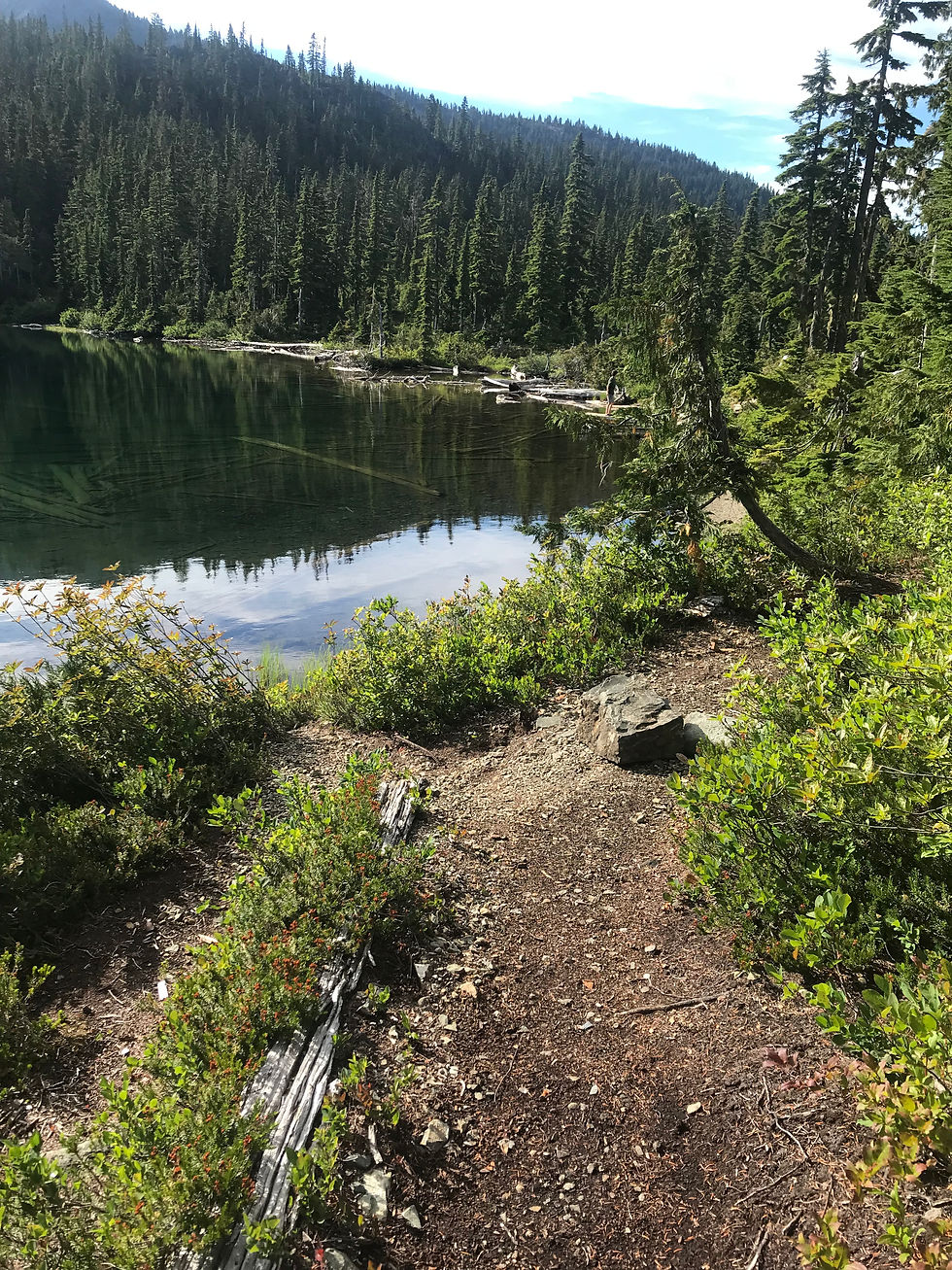
The hike from trailhead to 'basecamp' is a steady plod along an even 9km, popular among dayhikers and families with kids. Past Circlet Lake, the trail becomes steeper, climbing up the shoulder of a high plateau - an unexpected boulder move had us removing our packs at one point. Nearing the treeline, vegetation becomes scarce, and sun/heat exposure in the summer are probably one of the biggest challenges. Don't be fooled by how close the summit looks from the cairn - it's another 4 km one-way through rocky alpine terrain, plus a steep final grunt to the summit. To be perfectly honest, I am not disappointed with our uncompleted summit, because the coolest part for me was to be above the treeline for the first time. Sometimes, hiking/climbing is not about topping out, but getting cool photos and exploring an amazing mountain environment.
Beyond Mt Albert Edward, Forbidden Plateau offers so much potential for day hikes and multi-day trips. Another scrambling objective in the area is Castlecrag Mountain, an incredibly photogenic Class 3 scramble, however best reserved for more experienced hikers comfortable with GPS navigation. Read about our first Castlecrag attempt HERE (link valid when blue). Extending past AE, the Augerpoint Traverse is an epic off-trail adventure that descends to Ruth Masters Lake and Jack's Trail all the way to Buttle Lake.

Getting There:
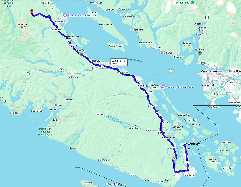
From Victoria, follow Trans - Canada Hwy/BC-1 N and BC-19 N to Nanaimo, then merge onto BC-19 North (Inland Island Hwy) to Courtenay. Take the exit for Dove Creek Rd /Strathcona Parkway, then follow signs upwards toward Mount Washington. At the ski resort, turn left off Strathcona Parkway onto Nordic Road to Raven Lodge. Some cars require chains on this section of the road in winter snow conditions (October through March/April).
Nearby Accommodation Options:
Comox Valley: The vibrant valley hosts three cities (Courtenay, Comox, and Cumberland) all which offer many Airbnb's, hotels, motels, and more. The Comox Valley is about 1hr - 30 mins away from the trailhead.
Mt Washington Ski Resort: Dominated by mountain bikers and hikers in summertime, the ski resort village is conveniently 5 mins from the trailhead. The number of hotels and lodges grows every year, but know that almost all restaurants are specifically ski-oriented and will be closed for summer. Be aware that there is no grocery store or gas station on the mountain, the nearest would be ~30 mins driving to Courtenay.

Backcountry Camping Fees:
For this hike, standard Strathcona Provincial Park Backcountry Camping fees apply during the summer months (June 15 - September 30). This information is current as of August 2026:
16+ years old: $10
6-15 years old: $5
Under 6: No fee
Learn more about Strathcona Provincial Park's regulations at https://bcparks.ca/strathcona-park/#camping
While camping, please follow standard Leave No Trace principles and use all available food caches (or suspend food from trees, if needed). On this hike there are urine-diversion outhouses located at the trailhead, Lake Helen Mackenzie, and Circlet Lake. Kwai, Croteau, and Battleship Lakes also have campsites/group sites with bear caches and toilets, but they are not on the immediate trail to AE and would require a long unnecessary detour. Should you need to improvise a camping bathroom, please stay away from drinking water sources and head at least 50m upslope.

Trail Description:
Paradise Meadows Official Trailhead (Raven Lodge)
0 - 3 km: Well-graded gravel paths and boardwalks, part of the Centennial Circuit
3.0 km: Lake Helen Mackenize
3 - 6 km: Circle west around Lake Helen Mackenzie and over the saddle between Mt Allan Brooks and Mt Elma to the Ranger Cabin. Steep switchbacks.
6 km: Forbidden Plateau Ranger Cabin and the junction to Kwai, Croteau, and Battleship Lakes
6 - ~10 km: Steady elevation gain along a rooty trail through subalpine meadows to Circlet Lake. Several up-and-downs!
~10 km: Duck Pond and Circlet Lake (first-come, first-serve)
10.5 - 11.5 km: Take right at Albert Edward/Moat Lake junction. Steep switchbacks and rooty scrambling terrain.
11.5 - 12 km: Exit onto a plateau. Trail markers are harder to spot. Follow cairns/markers until a rocky slope out of the treeline and onto the ridge.
12.0 km: Official Junction (cairn). Take right for Jutland Mountain, and left for: AE summit and Castlecrag via Frink Col (Moat Lake circuit counter-clockwise.
12 - 16 km: Exposed, wide rocky ridgeline. 8-foot luminium poles spaced ~3m apart are the only reliable trail markers. Snow may linger into the summer months. Be cautious in whiteout as accidentally descending into the Frink Col has accounted for many SAR incidents. Steep final push to AE true summit.
16.0 km: AE summit.
Trail Extensions:
Moat Lake Circuit: ~25km loop traversing the alpine ridge network by linking AE, Mt Frink, and Castlecrag via Moat Lake. Take right at the Frink Col. Be aware that this trail is not marked and crosses technical scrambling environments.
Augerpoint Traverse: Another linkup best saved for the experienced - or your Strathcona bucketlist. Look for informal markings to descend down the left flank from AE summit. It is another 20+ km of difficult backcountry terrain/informal camping to Westmin Mine Road.


DAY 1:
Trailhead - Lake Helen Mackenzie - Ranger Cabin - Circlet Lake
~10 km
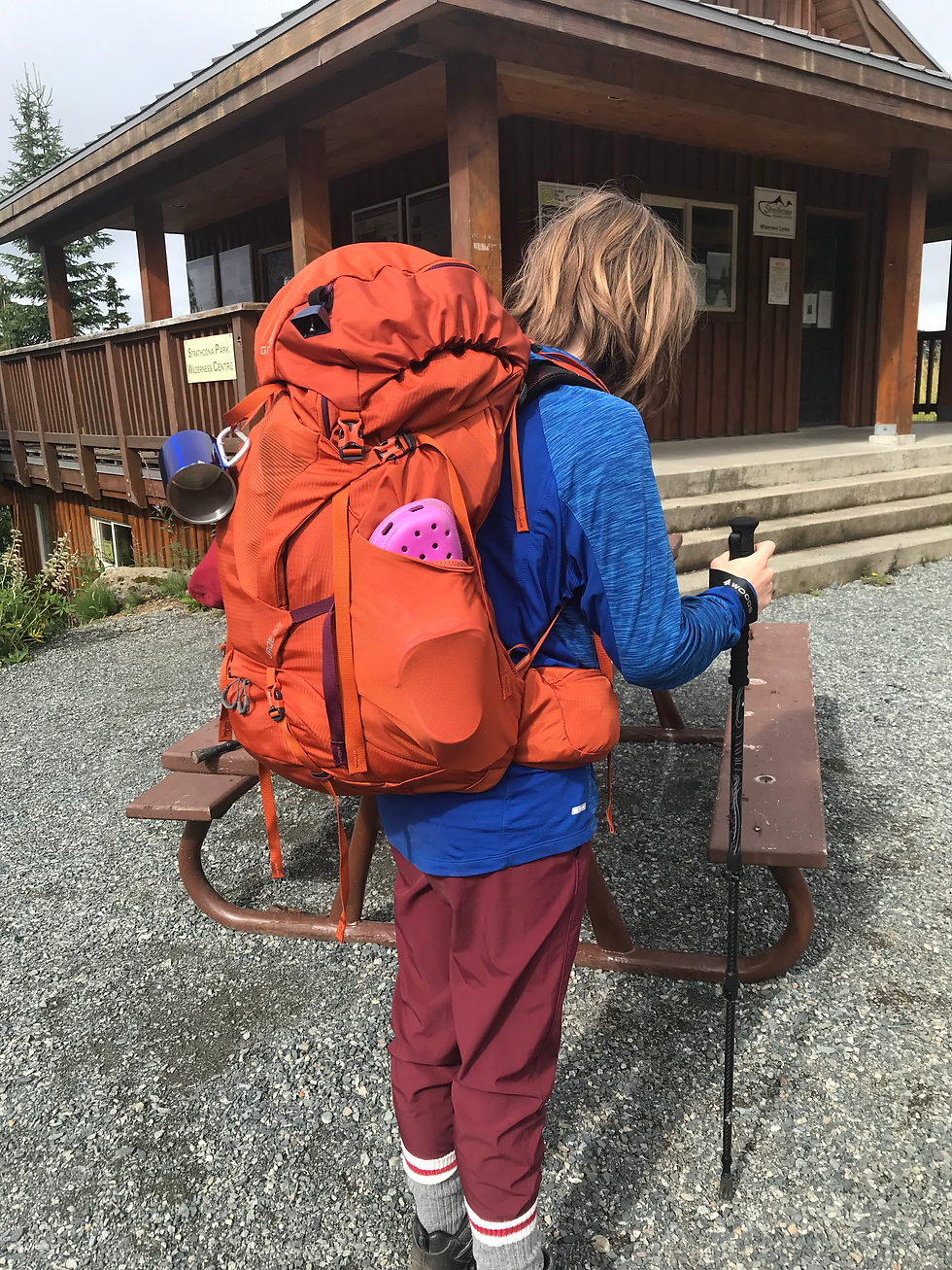
We drove up to Raven Lodge not too early at about 10 am, and it wasn't too hot for July because the sky was looking cloudy. I was excited but the pack was REALLY heavy... I definitely could have prepared for that first hike a little better.
The first part of the trail went slow for us, consisting of adjusting packs and eating unnecessary amounts of candy... this is a recurring isue 🫣. Unfortunately I do not have very many photos from this trip in 2024, so certain important landmarks are substituted with my 2026 documentation.


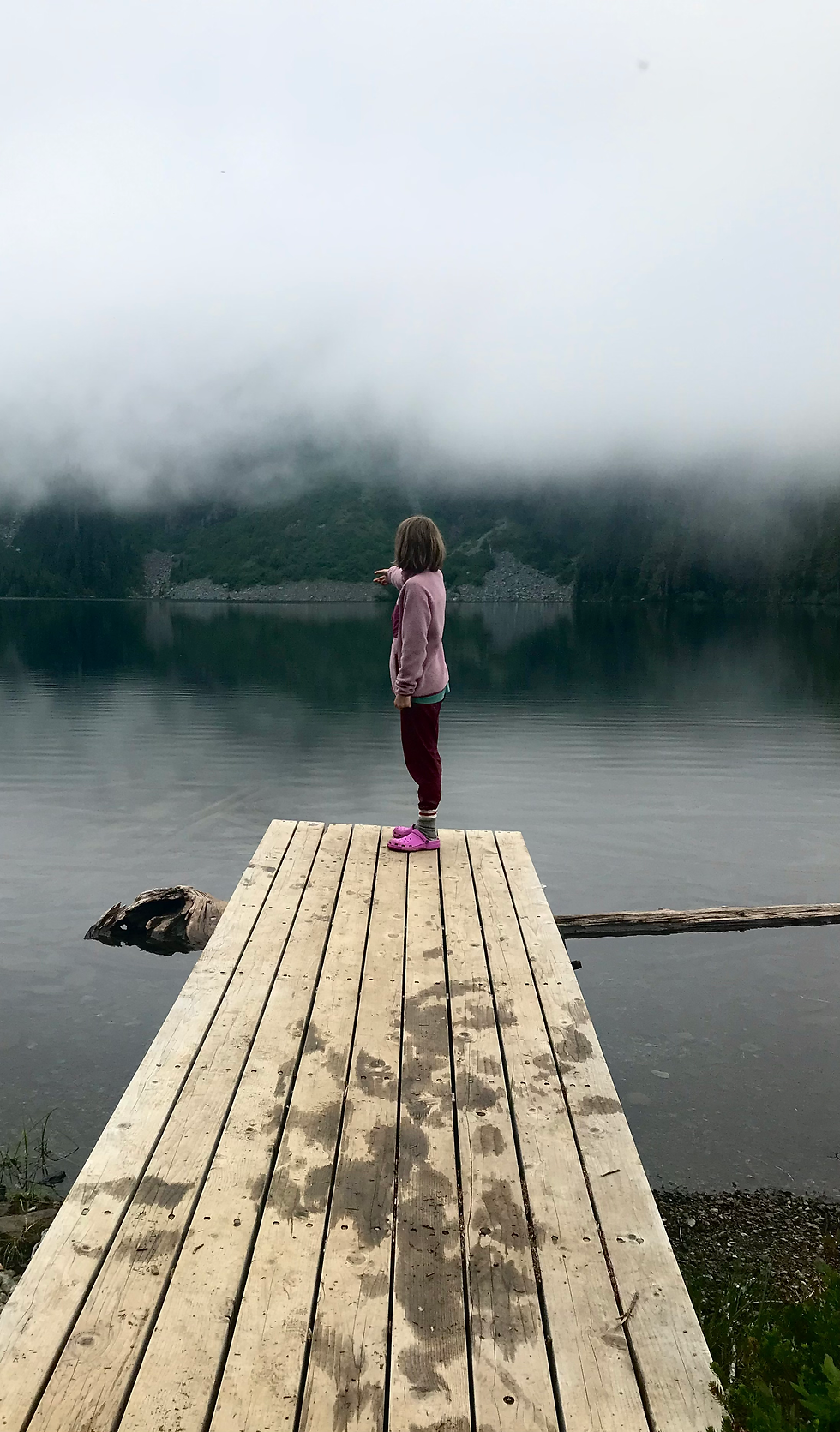
Circlet Lake is a fairly good campsite for the backcountry. By the numbers, there are...
60 tent pads (along eastern side of the lake between Duck Pond and Goss Creek)
4 sets of outhouse + dishwashing sink + bear cache spaced throughout
3 wooden docks along the shore
Water sources are as follows:
Duck Pond (the first tarn seen upon arrival, mistakenly believed to be Circlet Lake. Water from this pond should be filtered very well as looks quite stagnant.)
Circlet Lake (about a 5-10 min walk left from the main trail to all sites, not immediately visible. The main water source of the area and fairly clean.)
Goss Creek (walking to the end of the campsites along the lake, several faint trails lead right to a bubbling stream. This was our preferred water source for both drinking water and washing dishes.)
Almost all campsites are right next to water sources or within a ~3 min walk away.



DAY 2:
Circlet Lake - Official Cairn - route continues to AE Summit
~4 km roundtrip (full route: 12 km roundtrip)

I do not have any photos of breakfast and packing up, but long story short, we removed almost all unnecessary weight from our packs and left camp just before 10 am, carrying the bare essentials.


All the summits listed above can be linked together via the epic Moat Lake Circuit, a 20+km adventure best saved for the more experienced scrambler. We attempted Castlecrag in 2026 but were turned down by bad weather and dangerous conditions (Blog post: click here). Another 2027 attempt is coming up in the plans...


On note of cairns:
In the backcountry, especially transitioning into the alpine, cairns are sometimes your only visible tool of navigation. On remote BC mountains where the only travellers are the occasional climbers, cairns are probably what you're looking for as trail markers. However, they should never replace your GPS and printed map, no matter where you are.
Cairns can mean a variety of different things, from marking the campground to a simple "we were here," and sometimes it's not your next turn or junction. On highly popular hikes like Albert Edward, be cautious of following the odd cairn. People who do not hike in the backcountry regularly build them without reason and mislead knowledgeable hikers.
Always check your navigational devices and think twice before going in the direction of one odd rock pile. Building your own, correct cairns isn't a bad idea as well!

When to turn back is a hot topic in the mountain world. Summit fever is a term used in mountaineering to describe a strong urge to reach the summit at all costs, despite obstacles like weather, terrain, fatigue, runouts, oxygen, and etc. Even I am guilty of my disappointment when we turn back before the final goal.
Social media can make Albert Edward look like a casual weekend outing. We see climbers online pushing through the most horrible conditions, risking their lives and making it seem like a funny adventure afterwards. Nobody shows the full context behind their decisions, so it's easy to mistake a cool-looking story for an example worth following.
"Turning back at the slightest hint of clouds" might sound like an overreaction, but in reality, SAR incidents can occur anywhere. Forbidden Plateau in Strathcona is infamous for attracting clouds and getting them "stuck" between the network of ridges. These clouds move fast and roll in/out in minutes. Ridges are a dangerous place to be in low visibility conditions because you won't be able to tell which direction the route continues in. Albert Edward's ridge, for example, curves in a steep right-angle at the halfway mark, resulting in many people getting off-trail every year.


It was a very hot day and as the ridge offered no shade at all, we knew we couldn't possibly hike another 8 km to the summit before turnaround time.


We made it to camp at about 3 pm, totalling at 6 hours of hiking. Slow progress for 4 km, so I'm excited to return to this hike in the future and see how long it will take me to complete the full 12 km, lake to summit and back.


DAY 3:
Circlet Lake - Ranger Cabin - Lake Helen Mackenzie - Trailhead
~10 km
I do not have any photos of the way back, but we packed up around ~9 am and left before 10, give or take an hour. Progress was fast, and although it was hot, we made it to Lake Helen Mackenzie at 1:30 in the afternoon.


Looking back, I wish I had taken more photos and packed my backpack properly. But of course, 11-year-old me didn't know that I'd be writing a blog three years later...
What surprised you the most hiking Mt Albert Edward? Let me know in the comments!
Thank you so much for reading my post and making it to end! It means a lot to know someone took the time to read this!
✉️ Email sophia.roukhlova@gmail.com for any questions, inquiries, or collabs!
👇 Drop a comment below to tell me what you think!
🙏❤️ I always appreciate hearing your feedback
Enjoy your hike!
-- Sophia


Comments